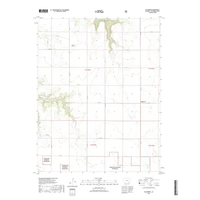
2019 Map of Villegreen
USGS Topo · Published 2019About this map
Comanche National Grassland dominates the southern reaches of this section of Las Animas County, where the high plains meet the intricate drainages of the Purgatoire River watershed. The small settlement of Villegreen sits at a crossroads in the eastern portion of the map, serving as a focal point for the surrounding ranching and agricultural lands. The terrain is defined by deep incisions in the landscape, most notably the winding paths of Plum Canyon and Poitrey Canyon. These canyons, along with their seasonal waterways Plum Cr and Poitrey Cr, create a complex topography of mesas and draws. Of particular interest to local historians is the Seven D Pocket, a distinctive geographic depression that reflects the naming conventions of early cattle ranching era in this part of southeastern Colorado.
Find a feature on this map
26 named features on this map. Tap any name to fly to it.
Don’t see what you’re looking for? This feature index may not catch every label — zoom into the map to look around manually.
Map Details
Editions of this 2019 Villegreen Map
This is the sole edition of this map. No revisions or reprints were ever made.
Other maps of this area

1891 · Mesa De Maya
USGS Topo · 1:125,000

1892 · Mt Carrizo
USGS Topo · 1:125,000

1893 · Mesa de Maya
USGS Topo · 1:125,000

1955 · La Junta
USGS Topo · 1:250,000

1958 · La Junta
USGS Topo · 1:250,000

1968 · La Junta
USGS Topo · 1:250,000

1972 · Johnson Canyon
USGS Topo · 1:24,000

1972 · Miners Peak
USGS Topo · 1:24,000

1972 · Plum Canyon
USGS Topo · 1:24,000

1972 · Tobe
USGS Topo · 1:24,000