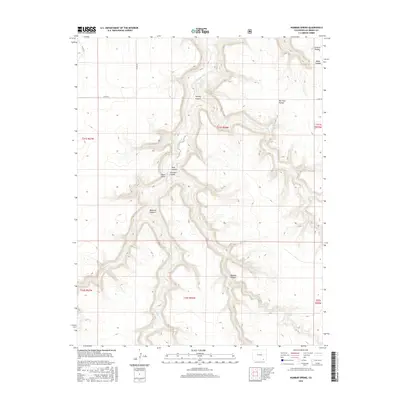
2016 Map of Humbar Spring
USGS Topo · Published 2016About this map
Humbar Spring and the surrounding drainage basins define this arid section of Las Animas County. The landscape is dominated by complex canyon systems, including Poitrey Canyon, Chacuaco Canyon, and Bachicha Canyon, which channel seasonal water through Chacuaco Cr and Poitrey Cr. These canyons create natural enclaves known locally as pockets, such as Seven D Pocket and Bar Four Pocket, which provided essential sheltered grazing and water access for ranching operations in this high-desert environment.
Find a feature on this map
25 named features on this map. Tap any name to fly to it.
Don’t see what you’re looking for? This feature index may not catch every label — zoom into the map to look around manually.
Map Details
Editions of this 2016 Humbar Spring Map
This is the sole edition of this map. No revisions or reprints were ever made.
Other maps of this area

1891 · Mesa De Maya
USGS Topo · 1:125,000

1893 · Mesa de Maya
USGS Topo · 1:125,000

1955 · La Junta
USGS Topo · 1:250,000

1958 · La Junta
USGS Topo · 1:250,000

1968 · La Junta
USGS Topo · 1:250,000

1972 · Johnson Canyon
USGS Topo · 1:24,000

1972 · Doss Canyon North
USGS Topo · 1:24,000

1972 · Miners Peak
USGS Topo · 1:24,000

1972 · Plum Canyon
USGS Topo · 1:24,000

1972 · Tobe
USGS Topo · 1:24,000