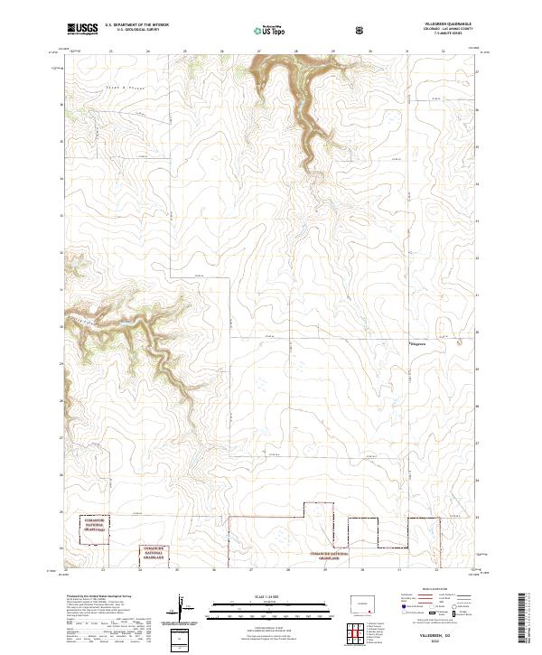
2022 Map of Villegreen
USGS Topo · Published 2022About this map
Comanche National Grassland dominates the southern landscape of this Las Animas County quadrangle, where the high plains meet the intricate drainage systems of the canyonlands. The small settlement of Villegreen sits at a crossroads of section-line roads, notably Co RD 179 and Co RD 44, representing the sparse but enduring ranching culture of Southeast Colorado. The terrain is deeply carved by water, with Poitrey Cr and Plum Cr cutting through the mesas. In the northwest, the distinctive Seven D Pocket and Poitrey Canyon reveal a landscape defined by erosion and remote grazing lands. The map illustrates a grid of county roads, such as Co RD 50 and Co RD 173, that stitch together distant parcels of public and private land within the vast prairie.
Find a feature on this map
25 named features on this map. Tap any name to fly to it.
Don’t see what you’re looking for? This feature index may not catch every label — zoom into the map to look around manually.
Map Details
Editions of this 2022 Villegreen Map
This is the sole edition of this map. No revisions or reprints were ever made.
Other maps of this area

1891 · Mesa De Maya
USGS Topo · 1:125,000

1892 · Mt Carrizo
USGS Topo · 1:125,000

1893 · Mesa de Maya
USGS Topo · 1:125,000

1955 · La Junta
USGS Topo · 1:250,000

1958 · La Junta
USGS Topo · 1:250,000

1968 · La Junta
USGS Topo · 1:250,000

1972 · Johnson Canyon
USGS Topo · 1:24,000

1972 · Miners Peak
USGS Topo · 1:24,000

1972 · Plum Canyon
USGS Topo · 1:24,000

1972 · Tobe
USGS Topo · 1:24,000