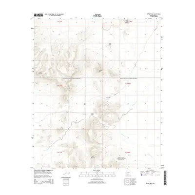
2014 Map of Bates Well
USGS Topo · Published 2014About this map
Bates Well sits at the heart of this desert landscape, a vital point of interest situated along the rugged Bates Well Rd. This portion of the Organ Pipe Cactus National Monument is defined by a series of prominent peaks and canyons, including the Growler Mountains to the west and the Bates Mountains to the south. The terrain is marked by significant topographical features such as Growler Pass, Growler Canyon, and the strikingly named John the Baptist Mountains in the northeast.
Find a feature on this map
19 named features on this map. Tap any name to fly to it.
Don’t see what you’re looking for? This feature index may not catch every label — zoom into the map to look around manually.
Map Details
Editions of this 2014 Bates Well Map
This is the sole edition of this map. No revisions or reprints were ever made.
Other maps of this area

1932 · Ajo
USGS Topo · 1:62,500

1934 · Ajo
USGS Topo · 1:62,500

1953 · Ajo
USGS Topo · 1:250,000

1957 · Ajo
USGS Topo · 1:250,000

1958 · Ajo
USGS Topo · 1:250,000

1962 · Ajo
USGS Topo · 1:250,000

1963 · Ajo
USGS Topo · 1:250,000

1963 · Ajo
USGS Topo · 1:62,500

1963 · Kino Peak
USGS Topo · 1:62,500

1964 · Growler Peak
USGS Topo · 1:62,500