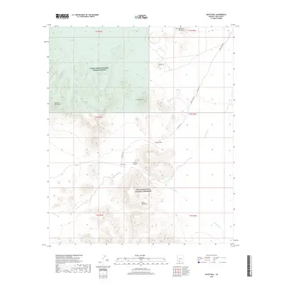
2018 Map of Bates Well
USGS Topo · Published 2018About this map
Bates Well sits at a critical junction in this desert landscape, where the Bates Well Road navigates between prominent desert ranges. This 2018 survey illustrates the protected boundary between the Cabeza Prieta National Wildlife Refuge and the Organ Pipe Cactus National Monument. The terrain is defined by the high ridges of the Growler Mountains and the Bates Mountains, separated by the strategically located Growler Pass and Growler Canyon. To the north, the John the Baptist Mountains and Scarface Mtn rise above the drainage basins. Water movement is etched into the land through the branching paths of the Growler Wash, Cuerda de Lena, and Cherioni Wash, which represent the rare ephemeral hydrology of the Sonoran Desert. The map preserves the sparse human infrastructure and naming conventions used by the Bureau of Land Management and other federal agencies in this conservation area.
Find a feature on this map
20 named features on this map. Tap any name to fly to it.
Don’t see what you’re looking for? This feature index may not catch every label — zoom into the map to look around manually.
Map Details
Editions of this 2018 Bates Well Map
This is the sole edition of this map. No revisions or reprints were ever made.
Other maps of this area

1932 · Ajo
USGS Topo · 1:62,500

1934 · Ajo
USGS Topo · 1:62,500

1953 · Ajo
USGS Topo · 1:250,000

1957 · Ajo
USGS Topo · 1:250,000

1958 · Ajo
USGS Topo · 1:250,000

1962 · Ajo
USGS Topo · 1:250,000

1963 · Ajo
USGS Topo · 1:250,000

1963 · Ajo
USGS Topo · 1:62,500

1963 · Kino Peak
USGS Topo · 1:62,500

1964 · Growler Peak
USGS Topo · 1:62,500