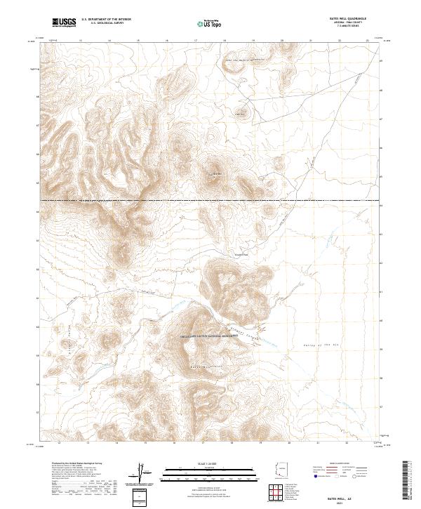
2021 Map of Bates Well
USGS Topo · Published 2021About this map
Bates Well Road serves as the primary artery through this arid Pima County landscape, connecting the vast protected lands of the Cabeza Prieta National Wildlife Refuge and the Organ Pipe Cactus National Monument. The terrain is defined by dramatic desert ranges, including the Bates Mountains, the Growler Mountains, and the John the Baptist Mountains. These peaks rise sharply above Growler Valley and the Valley of the Ajo, intersected by seasonal drainages like Growler Wash and Cherioni Wash. A significant topographical break occurs at Growler Pass, where the road and wash pass through the northern end of Growler Canyon. This 2021 survey illustrates the modern boundaries and land management of a region characterized by its isolated mountain masses, such as Scarface Mtn and Lime Hill, which historically dictated travel routes and water access in this segment of the Sonoran Desert.
Find a feature on this map
22 named features on this map. Tap any name to fly to it.
Don’t see what you’re looking for? This feature index may not catch every label — zoom into the map to look around manually.
Map Details
Editions of this 2021 Bates Well Map
This is the sole edition of this map. No revisions or reprints were ever made.
Other maps of this area

1932 · Ajo
USGS Topo · 1:62,500

1934 · Ajo
USGS Topo · 1:62,500

1953 · Ajo
USGS Topo · 1:250,000

1957 · Ajo
USGS Topo · 1:250,000

1958 · Ajo
USGS Topo · 1:250,000

1962 · Ajo
USGS Topo · 1:250,000

1963 · Ajo
USGS Topo · 1:250,000

1963 · Ajo
USGS Topo · 1:62,500

1963 · Kino Peak
USGS Topo · 1:62,500

1964 · Growler Peak
USGS Topo · 1:62,500