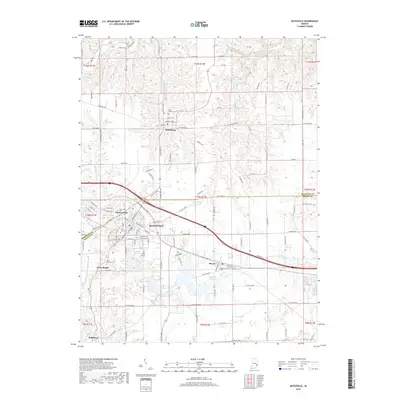
2019 Map of Batesville
USGS Topo · Published 2019About this map
Oldenburg and Batesville anchor this corner of southeastern Indiana, where the borders of Franklin and Ripley counties meet. The landscape is defined by the headwaters of Little Laughery Cr and Salt Creek, with numerous smaller tributaries like Bobs Cr and Harvey Branch carving into the terrain. The area shows a high density of religious and commemorative sites, including Holy Family Cem in the north and the Saint Louis Cem and Saint Johns Cem near the central urban corridors.
Find a feature on this map
123 named features on this map. Tap any name to fly to it.
Don’t see what you’re looking for? This feature index may not catch every label — zoom into the map to look around manually.
Map Details
Editions of this 2019 Batesville Map
This is the sole edition of this map. No revisions or reprints were ever made.
Other maps of this area

1946 · Pierceville
USGS Topo · 1:24,000

1946 · Batesville
USGS Topo · 1:24,000

1946 · Osgood
USGS Topo · 1:24,000

1946 · New Point
USGS Topo · 1:24,000

1953 · Cincinnati
USGS Topo · 1:250,000

1956 · Metamora
USGS Topo · 1:24,000

1956 · Brookville
USGS Topo · 1:24,000

1957 · Cincinnati
USGS Topo · 1:250,000

1958 · Spades
USGS Topo · 1:24,000

1958 · Clarksburg
USGS Topo · 1:24,000