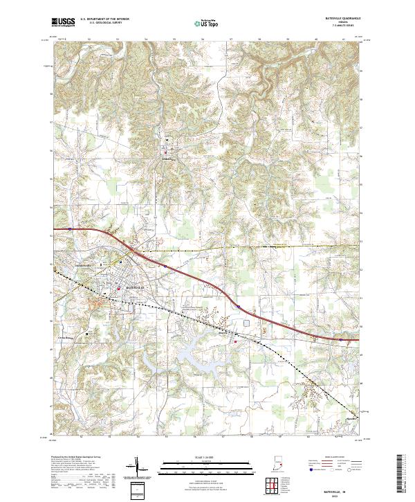
2022 Map of Batesville
USGS Topo · Published 2022About this map
Batesville serves as the primary hub in this southeastern Indiana landscape, where the convergence of industrial and educational growth is evident at the Ivy Tech Community College Batesville Campus. The area's cultural heritage is anchored by Oldenburg to the north, notable for its concentrated religious and civic core including Holy Family Cem. This 2022 survey illustrates a region defined by managed water resources, with several large basins such as Bischoff Reservoir, Feller Reservoir, and Oser Reservoir supporting the local population. Smaller outlying settlements like Huntersville, Morris, and Spades maintain their distinct identities along the road and rail corridors. Genealogists will find the documentation of Saint Johns Cem, Saint Louis Cem, and Saint Pauls Cem particularly useful for tracing local family lineages across the Franklin and Ripley county line.
Find a feature on this map
73 named features on this map. Tap any name to fly to it.
Don’t see what you’re looking for? This feature index may not catch every label — zoom into the map to look around manually.
Map Details
Editions of this 2022 Batesville Map
This is the sole edition of this map. No revisions or reprints were ever made.
Other maps of this area

1946 · Pierceville
USGS Topo · 1:24,000

1946 · Batesville
USGS Topo · 1:24,000

1946 · Osgood
USGS Topo · 1:24,000

1946 · New Point
USGS Topo · 1:24,000

1953 · Cincinnati
USGS Topo · 1:250,000

1956 · Metamora
USGS Topo · 1:24,000

1956 · Brookville
USGS Topo · 1:24,000

1957 · Cincinnati
USGS Topo · 1:250,000

1958 · Spades
USGS Topo · 1:24,000

1958 · Clarksburg
USGS Topo · 1:24,000