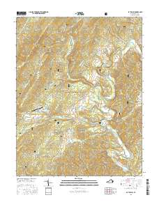
2016 Map of Bath Alum
USGS Topo · Published 2016About this map
The Cowpasture River valley and its surrounding ridges dominate this 2016 survey of Bath County. The settlement at Bath Alum serves as a local focal point near the Bath Alum Airport and the recreational waters of Lake of the Pines. Much of the eastern and western terrain is protected within the George Washington National Forest, where steep ridges like Warm Springs Mtn and McClung Ridge define the landscape. This map documents a region characterized by numerous named hollows and drafts, such as Hickman Draft and Venable Hollow, which illustrate the complex drainage patterns of the Allegheny Mountains. The presence of Big Spring and the winding State Rte 629 through the McClung area highlights the long-standing transportation and water-resource patterns that have shaped the small communities in this part of Virginia.
Find a feature on this map
65 named features on this map. Tap any name to fly to it.
Don’t see what you’re looking for? This feature index may not catch every label — zoom into the map to look around manually.
Map Details
Editions of this 2016 Bath Alum Map
This is the sole edition of this map. No revisions or reprints were ever made.
Other maps of this area

1894 · Natural Bridge
USGS Topo · 1:125,000

1901 · Monterey
USGS Topo · 1:125,000

1923 · Warm Springs
USGS Topo · 1:48,000

1926 · Warm Springs
USGS Topo · 1:62,500

1930 · Warm Springs Run
USGS Topo · 1:24,000

1931 · Healing Springs
USGS Topo · 1:24,000

1933 · Warm Springs Run
USGS Topo · 1:31,680

1933 · Healing Springs
USGS Topo · 1:31,680

1945 · Clifton Forge
USGS Topo · 1:62,500

1946 · Millboro
USGS Topo · 1:62,500