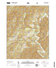
2019 Map of Bath Alum
USGS Topo · Published 2019About this map
McClung and Bath Alum serve as the primary hubs in this section of Bath County, where the valley floor of the Cowpasture River meets the steep ascent of the Alleghenies. Much of the western terrain is dominated by the George Washington National Forest, characterized by prominent peaks like Warm Springs Mtn and Tower Hill Mountain. The map reveals a landscape defined by its hydrography and topography, from the drainage of Thompson Cr to the high-elevation gaps of Gates Hollow and Wide Draft Hollow. Local infrastructure is represented by the Bath Alum Airport and a network of secondary routes such as River Rd and State Rte 629. For those interested in recreation or land use, the presence of the Mare Run Trl and various springs like Big Spring highlight the area's natural resources and transition from managed forest to rural valley settlements.
Find a feature on this map
89 named features on this map. Tap any name to fly to it.
Don’t see what you’re looking for? This feature index may not catch every label — zoom into the map to look around manually.
Map Details
Editions of this 2019 Bath Alum Map
This is the sole edition of this map. No revisions or reprints were ever made.
Other maps of this area

1894 · Natural Bridge
USGS Topo · 1:125,000

1901 · Monterey
USGS Topo · 1:125,000

1923 · Warm Springs
USGS Topo · 1:48,000

1926 · Warm Springs
USGS Topo · 1:62,500

1930 · Warm Springs Run
USGS Topo · 1:24,000

1931 · Healing Springs
USGS Topo · 1:24,000

1933 · Warm Springs Run
USGS Topo · 1:31,680

1933 · Healing Springs
USGS Topo · 1:31,680

1945 · Clifton Forge
USGS Topo · 1:62,500

1946 · Millboro
USGS Topo · 1:62,500