
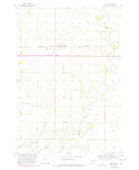
1954 Map of Bath
USGS Topo · Published 1955About this map
The James River and its intricate meanders dominate this mid-century survey of Brown County, where a system of Levee works attempts to manage the seasonal flooding of the prairie landscape. The settlement of Bath serves as a central hub, situated along the Chicago Milwaukee St Paul and Pacific railroad line, which provides the primary industrial corridor through the region. At Bath Corner, the intersection of local routes reflects the rural grid system that defines the township boundaries of Bath and Gem.
Find a feature on this map
14 named features on this map. Tap any name to fly to it.
Don’t see what you’re looking for? This feature index may not catch every label — zoom into the map to look around manually.
Map Details
Editions of this 1954 Bath Map
2 editions found
Other maps of this area

1894 · Columbia
USGS Topo · 1:62,500

1895 · Aberdeen
USGS Topo · 1:125,000

1896 · Columbia
USGS Topo · 1:125,000

1952 · Columbia
USGS Topo · 1:24,000

1952 · Ordway
USGS Topo · 1:24,000

1952 · Putney
USGS Topo · 1:24,000

1953 · Stratford
USGS Topo · 1:24,000

1953 · Groton SW
USGS Topo · 1:24,000

1953 · Warner
USGS Topo · 1:24,000

1954 · James
USGS Topo · 1:24,000