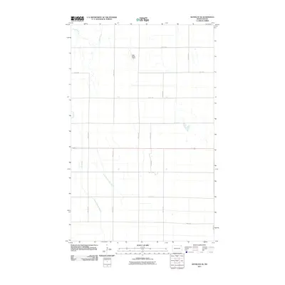
2011 Map of Bathgate SE
USGS Topo · Published 2011About this map
Agricultural patterns and water management systems define this section of Pembina County in the early 21st century. The landscape is structured by an extensive grid of section roads, including Carlisle Rd and 155th Ave NE, which facilitate movement between sprawling farmsteads. The natural course of the Tongue River and the meandering Big Slough are supplemented by man-made drainage engineering, such as County Ditch Number 16A and County Ditch Number 16. These features illustrate the intensive effort required to manage the Red River Valley's flat terrain for modern production. Apart from the road network, the Craig Private Airstrip serves as a lone aviation landmark in this rural expanse, highlighting the integration of private transport within the local farming economy.
Find a feature on this map
22 named features on this map. Tap any name to fly to it.
Don’t see what you’re looking for? This feature index may not catch every label — zoom into the map to look around manually.
Map Details
Editions of this 2011 Bathgate SE Map
This is the sole edition of this map. No revisions or reprints were ever made.
Other maps of this area

1939 · Drayton
USGS Topo · 1:62,500

1939 · Glasston
USGS Topo · 1:62,500

1939 · Pembina
USGS Topo · 1:62,500

1941 · Drayton
USGS Topo · 1:62,500

1941 · Glasston
USGS Topo · 1:62,500

1941 · Bathgate
USGS Topo · 1:62,500

1941 · Pembina
USGS Topo · 1:62,500

1952 · Thief River Falls
USGS Topo · 1:250,000

1956 · Thief River Falls
USGS Topo · 1:250,000

1957 · Thief River Falls
USGS Topo · 1:250,000