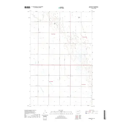
2017 Map of Bathgate SE
USGS Topo · Published 2017About this map
Tongue River winds through the northwestern corner of this landscape in Pembina County, marking a subtle change in a terrain otherwise defined by its agricultural grid. The map reveals an intricate network of water management features essential to the Red River Valley’s farming economy, including Big Slough, County Ditch Number 16A, and County Ditch Number 16. These engineered waterways, alongside Icelandic Coulee, provide a clear picture of how the land has been shaped for drainage and cultivation.
Find a feature on this map
23 named features on this map. Tap any name to fly to it.
Don’t see what you’re looking for? This feature index may not catch every label — zoom into the map to look around manually.
Map Details
Editions of this 2017 Bathgate SE Map
This is the sole edition of this map. No revisions or reprints were ever made.
Other maps of this area

1939 · Drayton
USGS Topo · 1:62,500

1939 · Glasston
USGS Topo · 1:62,500

1939 · Pembina
USGS Topo · 1:62,500

1941 · Drayton
USGS Topo · 1:62,500

1941 · Glasston
USGS Topo · 1:62,500

1941 · Bathgate
USGS Topo · 1:62,500

1941 · Pembina
USGS Topo · 1:62,500

1952 · Thief River Falls
USGS Topo · 1:250,000

1956 · Thief River Falls
USGS Topo · 1:250,000

1957 · Thief River Falls
USGS Topo · 1:250,000