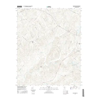
2017 Map of Baton Rouge
USGS Topo · Published 2017About this map
Baton Rouge sits within a complex network of drainage basins in Chester County, where the landscape is defined by the winding course of the Sandy River and its numerous tributaries. This 2017 study illustrates the modern rural character of the region, anchored by historical landmarks such as Mount Moriah Cem and Old Zion Cem. The terrain is significantly influenced by water management and recreation, evidenced by the Mountain Lakes Upper Lake and Mountain Lakes Lower Lake systems, as well as the Chester Reservoir to the northeast. Settlement patterns follow old corridors like Baton Rouge Rd and Pinckney Rd, while industrial and community history is represented by Gayle Mill and the family-associated waters of Walkers Mill Br. The map provides a precise look at property boundaries and rural infrastructure near the edge of the Piedmont.
Find a feature on this map
60 named features on this map. Tap any name to fly to it.
Don’t see what you’re looking for? This feature index may not catch every label — zoom into the map to look around manually.
Map Details
Editions of this 2017 Baton Rouge Map
This is the sole edition of this map. No revisions or reprints were ever made.
Other maps of this area

1907 · Sharon
USGS Topo · 1:62,500

1941 · Spartanburg
USGS Topo · 1:250,000

1949 · Rock Hill
USGS Topo · 1:62,500

1953 · Spartanburg
USGS Topo · 1:250,000

1960 · Spartanburg
USGS Topo · 1:250,000

1963 · Spartanburg
USGS Topo · 1:250,000

1964 · Spartanburg
USGS Topo · 1:250,000

1968 · Blackstock
USGS Topo · 1:24,000
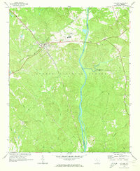
1969 · Carlisle
USGS Topo · 1:24,000

1969 · Baton Rouge
USGS Topo · 1:24,000