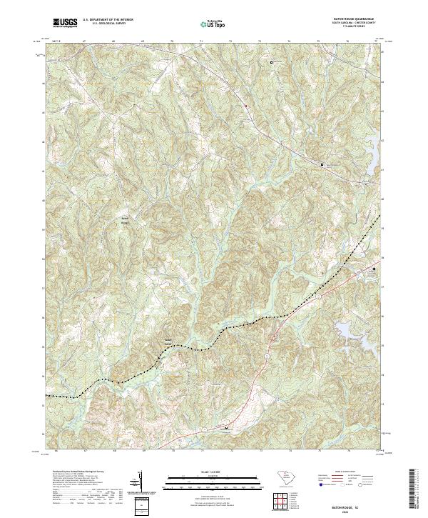
2024 Map of Baton Rouge
USGS Topo · Published 2024About this map
Sandy River and its complex network of tributaries define the topography of this corner of Chester County. The small settlement of Baton Rouge sits at a high point between Smith Creek and Starne Branch, serving as a central node for local routes like Baton Rouge Rd and W Chester School Rd. The landscape is heavily dissected by water, with Seeley Creek, Brushy Fork Creek, and Walkers Mill Branch carving through the terrain towards the main river channel.
Find a feature on this map
66 named features on this map. Tap any name to fly to it.
Don’t see what you’re looking for? This feature index may not catch every label — zoom into the map to look around manually.
Map Details
Editions of this 2024 Baton Rouge Map
This is the sole edition of this map. No revisions or reprints were ever made.
Other maps of this area

1907 · Sharon
USGS Topo · 1:62,500

1941 · Spartanburg
USGS Topo · 1:250,000

1949 · Rock Hill
USGS Topo · 1:62,500

1953 · Spartanburg
USGS Topo · 1:250,000

1960 · Spartanburg
USGS Topo · 1:250,000

1963 · Spartanburg
USGS Topo · 1:250,000

1964 · Spartanburg
USGS Topo · 1:250,000

1968 · Blackstock
USGS Topo · 1:24,000
1969 · Carlisle
USGS Topo · 1:24,000

1969 · Baton Rouge
USGS Topo · 1:24,000