
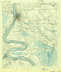
1908 Map of Baton Rouge
USGS Topo · Published 1921About this map
The Mississippi River defines the landscape of this 1906 survey, twisting through a network of points and bends that shaped the early development of Baton Rouge and Plaquemine. The map documents a transition in transport, showing the intricate rail systems of the Yazoo and Mississippi Valley RR and the Louisiana Railway and Navigation Company alongside the established river economy.
Find a feature on this map
74 named features on this map. Tap any name to fly to it.
Don’t see what you’re looking for? This feature index may not catch every label — zoom into the map to look around manually.
Map Details
Editions of this 1908 Baton Rouge Map
2 editions found
Other maps of this area

1892 · Donaldsonville
USGS Topo · 1:62,500

1906 · Bayou Sara
USGS Topo · 1:125,000

1934 · Denham Springs
USGS Topo · 1:62,500

1935 · Gonzales
USGS Topo · 1:31,680

1935 · Chicot Lake
USGS Topo · 1:62,500

1936 · White Castle
USGS Topo · 1:62,500

1939 · Zachary
USGS Topo · 1:62,500

1939 · Denham Springs
USGS Topo · 1:62,500

1939 · Baton Rouge
USGS Topo · 1:62,500

1939 · Donaldsonville
USGS Topo · 1:62,500