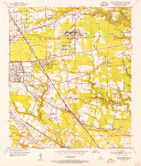
1953 Map of Baton Rouge East
USGS Topo · Published 1954About this map
Airline Highway and Florida Blvd anchor the expanding postwar landscape of eastern Baton Rouge. The transition from industrial infrastructure to residential development is evident in the sprawling grounds of the Baton Rouge Engineer Depot and the nearby East Baton Rouge Parish Airport. Established neighborhoods like Broadmoor and Goodwood are shown in detail, alongside the Baton Rouge Country Club, illustrating the mid-century suburban shift away from the city center.
Find a feature on this map
60 named features on this map. Tap any name to fly to it.
Don’t see what you’re looking for? This feature index may not catch every label — zoom into the map to look around manually.
Map Details
Editions of this 1953 Baton Rouge East Map
This is the sole edition of this map. No revisions or reprints were ever made.
Other maps of this area

1906 · Bayou Sara
USGS Topo · 1:125,000

1908 · Baton Rouge
USGS Topo · 1:62,500

1934 · Denham Springs
USGS Topo · 1:62,500

1939 · Zachary
USGS Topo · 1:62,500

1939 · Denham Springs
USGS Topo · 1:62,500

1939 · Baton Rouge
USGS Topo · 1:62,500

1942 · Watson
USGS Topo · 1:31,680

1953 · Baton Rouge West
USGS Topo · 1:24,000

1953 · Plaquemine
USGS Topo · 1:24,000

1953 · St. Gabriel
USGS Topo · 1:24,000