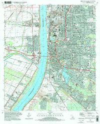
1995 Map of Baton Rouge West
USGS Topo · Published 1998About this map
The Mississippi River creates a sharp divide between the industrial and agricultural landscape of West Baton Rouge Parish and the dense urban core of the state capital. On the western bank, the Poplar Grove Plantation and the sugar-producing hub of Cinclare sit alongside the Port Allen waterfront, where the Intercoastal Waterway connects river traffic to coastal routes. This area reflects a long-standing reliance on waterborne commerce, with rail lines like the Kansas City Southern Railroad servicing the riverside docks.
Find a feature on this map
100 named features on this map. Tap any name to fly to it.
Don’t see what you’re looking for? This feature index may not catch every label — zoom into the map to look around manually.
Map Details
Editions of this 1995 Baton Rouge West Map
This is the sole edition of this map. No revisions or reprints were ever made.
Other maps of this area

1906 · Bayou Sara
USGS Topo · 1:125,000

1908 · Baton Rouge
USGS Topo · 1:62,500

1939 · Zachary
USGS Topo · 1:62,500

1939 · Baton Rouge
USGS Topo · 1:62,500

1940 · Grosse Tete
USGS Topo · 1:62,500

1953 · Baton Rouge West
USGS Topo · 1:24,000

1953 · Plaquemine
USGS Topo · 1:24,000

1953 · Lobdell
USGS Topo · 1:24,000

1953 · Addis
USGS Topo · 1:24,000

1953 · St. Gabriel
USGS Topo · 1:24,000