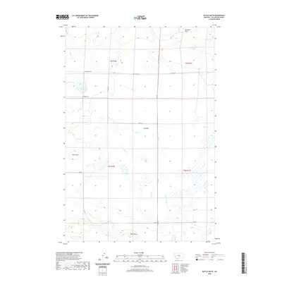
2020 Map of Battle Butte
USGS Topo · Published 2020About this map
Battle Butte and the Twin Buttes anchor this Stillwater County landscape, which is defined by an intricate network of intermittent drainage and large, shallow depressions. In the northern reaches, the broad Hailstone Basin and Lake Basin suggest a topography that collects seasonal runoff, while water bodies like Dallmann Lake provide rare permanent landmarks in an otherwise arid expanse. The hydrology is dominated by numerous small creeks, including Sixshooter Cr, Gurney Cr, and Cedar Cr, which carve subtle paths through the terrain. Human presence is evidenced primarily by a rigid section-line road system, including the Molt-Rapelje Rd and Flat Rd, which facilitate movement between the agricultural tracts and cattle ranges of this high-plains environment. The map captures a moment of modern land management where natural basins and legacy ranch roads dictate the local geography.
Find a feature on this map
25 named features on this map. Tap any name to fly to it.
Don’t see what you’re looking for? This feature index may not catch every label — zoom into the map to look around manually.
Map Details
Editions of this 2020 Battle Butte Map
This is the sole edition of this map. No revisions or reprints were ever made.
Other maps of this area

1889 · Big Snowy Mountain
USGS Topo · 1:250,000

1892 · Stillwater
USGS Topo · 1:125,000

1893 · Big Snowy Mountain
USGS Topo · 1:250,000

1954 · Billings
USGS Topo · 1:250,000

1954 · Roundup
USGS Topo · 1:250,000

1956 · Rapelje
USGS Topo · 1:24,000

1956 · Hunter Lake
USGS Topo · 1:24,000

1956 · Battle Butte
USGS Topo · 1:24,000

1956 · Wheat Basin
USGS Topo · 1:24,000

1956 · Lindemulder Hill
USGS Topo · 1:24,000