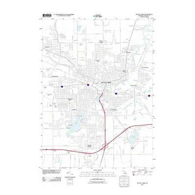
2011 Map of Battle Creek
USGS Topo · Published 2011About this map
Battle Creek serves as the central hub of this 2011 survey, where the confluence of the Kalamazoo River and the Battle Creek river defines the urban core. The city is surrounded by a dense network of suburban developments and historical neighborhoods including Orchard Park, Verona Park, and Greenfield Park. Transport infrastructure is prominent, featuring the W K Kellogg Airport on the western edge and the Grand Trunk Ave rail corridor.
Find a feature on this map
160 named features on this map. Tap any name to fly to it.
Don’t see what you’re looking for? This feature index may not catch every label — zoom into the map to look around manually.
Map Details
Editions of this 2011 Battle Creek Map
This is the sole edition of this map. No revisions or reprints were ever made.
Other maps of this area

1918 · Battle Creek
USGS Topo · 1:62,500

1918 · Union City
USGS Topo · 1:62,500

1918 · Galesburg
USGS Topo · 1:62,500

1918 · Leonidas
USGS Topo · 1:62,500

1943 · Battle Creek
USGS Topo · 1:62,500

1944 · Leonidas
USGS Topo · 1:62,500

1944 · Galesburg
USGS Topo · 1:62,500

1947 · Augusta
USGS Topo · 1:24,000

1947 · Banfield
USGS Topo · 1:24,000

1947 · Bellevue
USGS Topo · 1:24,000
Featured Places
- Battle Creek, MI
- Springfield, MI
- Emmett Charter Township, MI
- Urbandale, Battle Creek
- Sunrise Heights, MI