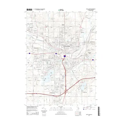
2014 Map of Battle Creek
USGS Topo · Published 2014About this map
Battle Creek sits at the confluence of the Kalamazoo River and Battle Cr, serving as a major center for aviation and education in Calhoun County. The expansive W K Kellogg Airport dominates the western landscape, while the Kellogg Community Coll campus and the industrial corridors along Grand Trunk Ave speak to the city's twentieth-century growth. For those tracing family histories, numerous burial grounds are detailed across the quadrangle, including the large Oak Hill Cem, Mt Olive Cem, and the more secluded Beckley Cem and Dubois Cem. The southern reach of the city is defined by recreational and residential development surrounding Goguac Lake, where Clark Island and Vince Island punctuate the water. To the east, Beadle Lake and Mud Lake offer a more transitionary landscape between the urban center and the outlying neighborhoods of Brownlee Park and Maplehurst.
Find a feature on this map
45 named features on this map. Tap any name to fly to it.
Don’t see what you’re looking for? This feature index may not catch every label — zoom into the map to look around manually.
Map Details
Editions of this 2014 Battle Creek Map
This is the sole edition of this map. No revisions or reprints were ever made.
Other maps of this area

1918 · Battle Creek
USGS Topo · 1:62,500

1918 · Union City
USGS Topo · 1:62,500

1918 · Galesburg
USGS Topo · 1:62,500

1918 · Leonidas
USGS Topo · 1:62,500

1943 · Battle Creek
USGS Topo · 1:62,500

1944 · Leonidas
USGS Topo · 1:62,500

1944 · Galesburg
USGS Topo · 1:62,500

1947 · Augusta
USGS Topo · 1:24,000

1947 · Banfield
USGS Topo · 1:24,000

1947 · Bellevue
USGS Topo · 1:24,000
Featured Places
- Battle Creek, MI
- Springfield, MI
- Emmett Charter Township, MI
- Urbandale, Battle Creek
- Sunrise Heights, MI