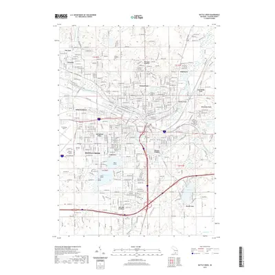
2019 Map of Battle Creek
USGS Topo · Published 2019About this map
Battle Creek is situated at the significant confluence of the Kalamazoo River and the Battle Creek river, forming a dense urban core surrounded by established neighborhoods like Urbandale, Lakeview, and Verona Park. The landscape is defined by its industrial and civic infrastructure, from the W K Kellogg Airport on the western edge to the Calhoun County Justice Center downtown. Genealogists will find a wealth of data across numerous burial grounds, including the large Oak Hill Cem and the Memorial Park Cem, alongside smaller family plots like the Harmon-Halladay Cem. Recreational and natural features are prominent, notably Goguac Lake with its islands—Ward Island, Clark Island, and Vince Island—and the N Country National Scenic Trail which winds through the city’s park systems. The map also detail local educational landmarks such as Kellogg Community College and a network of water bodies including Beadle Lake and Minges Brook.
Find a feature on this map
48 named features on this map. Tap any name to fly to it.
Don’t see what you’re looking for? This feature index may not catch every label — zoom into the map to look around manually.
Map Details
Editions of this 2019 Battle Creek Map
This is the sole edition of this map. No revisions or reprints were ever made.
Other maps of this area

1918 · Battle Creek
USGS Topo · 1:62,500

1918 · Union City
USGS Topo · 1:62,500

1918 · Galesburg
USGS Topo · 1:62,500

1918 · Leonidas
USGS Topo · 1:62,500

1943 · Battle Creek
USGS Topo · 1:62,500

1944 · Leonidas
USGS Topo · 1:62,500

1944 · Galesburg
USGS Topo · 1:62,500

1947 · Augusta
USGS Topo · 1:24,000

1947 · Banfield
USGS Topo · 1:24,000

1947 · Bellevue
USGS Topo · 1:24,000
Featured Places
- Battle Creek, MI
- Springfield, MI
- Emmett Charter Township, MI
- Urbandale, Battle Creek
- Sunrise Heights, MI