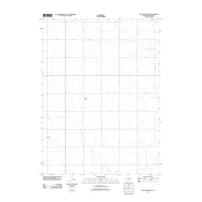
2011 Map of Battle Creek SE
USGS Topo · Published 2011About this map
Green Garden Cemetery and Kalamazoo Cemetery serve as the primary historic anchors for this rural landscape in Madison County. The terrain is defined by a dendritic network of small watercourses, including the westward-flowing Taylor Creek and the southern reaches of North Fork Union Creek. The settlement pattern follows a strict Section-Line grid, with roads such as 827 Rd and 830 Rd marking the agricultural layout of the central plains. Unlike more developed areas, this map reveals a landscape almost entirely dedicated to cultivation and drainage, where the small family and community cemeteries provide the only permanent structural evidence of the area's early residents and their local church-and-school community hubs. Union Creek traverses the southeastern corner, serving as the principal drainage for the surrounding farmsteads.
Find a feature on this map
15 named features on this map. Tap any name to fly to it.
Don’t see what you’re looking for? This feature index may not catch every label — zoom into the map to look around manually.
Map Details
Editions of this 2011 Battle Creek SE Map
This is the sole edition of this map. No revisions or reprints were ever made.
Other maps of this area

1955 · Fremont
USGS Topo · 1:250,000

1957 · Fremont
USGS Topo · 1:250,000

1958 · Fremont
USGS Topo · 1:250,000

1963 · Madison
USGS Topo · 1:24,000

1963 · Battle Creek
USGS Topo · 1:24,000

1963 · Emerick
USGS Topo · 1:24,000
1963 · Enola
USGS Topo · 1:24,000

1963 · Battle Creek SE
USGS Topo · 1:24,000

1963 · Battle Creek SW
USGS Topo · 1:24,000
1966 · Lindsay
USGS Topo · 1:24,000