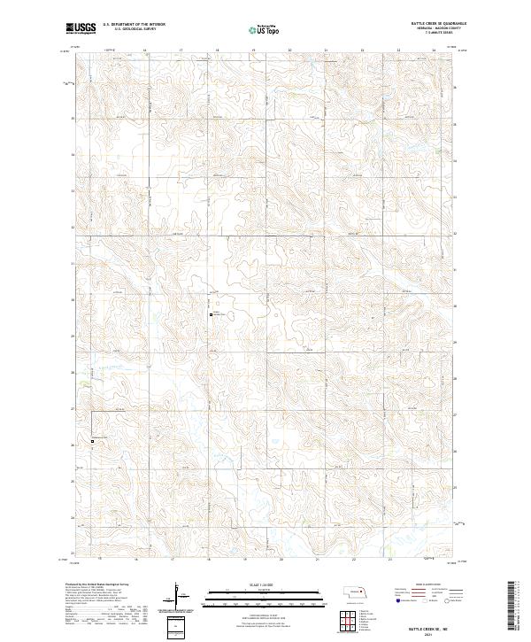
2021 Map of Battle Creek SE
USGS Topo · Published 2021About this map
Green Garden Cem and Kalamazoo Cem serve as quiet landmarks within this rural section of Madison County, providing essential touchstones for local genealogical research. The landscape is defined by the drainage patterns of Union Creek, including its North Fork, and Taylor Creek in the northeast. This 2021 topographic survey reveals a strictly organized grid of agricultural roads, such as 547th Ave and 828th Rd, which segment the terrain into traditional sections. While no major towns appear on this specific quadrangle, the placement of rural cemeteries and the complex network of creeks offer a precise record of land use and family holdings in the Nebraska countryside.
Find a feature on this map
26 named features on this map. Tap any name to fly to it.
Don’t see what you’re looking for? This feature index may not catch every label — zoom into the map to look around manually.
Map Details
Editions of this 2021 Battle Creek SE Map
This is the sole edition of this map. No revisions or reprints were ever made.
Other maps of this area

1955 · Fremont
USGS Topo · 1:250,000

1957 · Fremont
USGS Topo · 1:250,000

1958 · Fremont
USGS Topo · 1:250,000

1963 · Madison
USGS Topo · 1:24,000

1963 · Battle Creek
USGS Topo · 1:24,000

1963 · Emerick
USGS Topo · 1:24,000
1963 · Enola
USGS Topo · 1:24,000

1963 · Battle Creek SE
USGS Topo · 1:24,000

1963 · Battle Creek SW
USGS Topo · 1:24,000
1966 · Lindsay
USGS Topo · 1:24,000