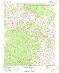
1974 Map of Battle Flat
USGS Topo · Published 1982About this map
Mining operations and remote homesteads define this rugged section of the Prescott National Forest in the mid-1970s. The landscape is dominated by the massive Bradshaw Mountains, where steep drainages like Turkey Creek and Mule Canyon descend toward the Gila and Salt River Meridian. The high country is marked by significant historical extraction sites, including the Tuscumbia Mine, Swastika Mine, and De Soto Mine, many of which are accessible only by winding jeep and pack trails that branch off the Senator Highway. These trails link the high-elevation Pine Flat and the namesake Battle Flat with water sources such as Granite Spring and Brushy Basin Spring. The map documents a period when the mountainous terrain remained largely defined by its subterranean mineral wealth and the sparse infrastructure of the high desert wilderness.
Find a feature on this map
64 named features on this map. Tap any name to fly to it.
Don’t see what you’re looking for? This feature index may not catch every label — zoom into the map to look around manually.
Map Details
Editions of this 1974 Battle Flat Map
3 editions found
Other maps of this area

1887 · Prescott
USGS Topo · 1:250,000

1892 · Prescott
USGS Topo · 1:250,000

1903 · Bradshaw Mountains
USGS Topo · 1:125,000

1947 · Crown King
USGS Topo · 1:62,500

1947 · Bumblebee
USGS Topo · 1:62,500

1947 · Mayer
USGS Topo · 1:62,500

1947 · Mt. Union
USGS Topo · 1:62,500

1948 · Bumblebee
USGS Topo · 1:63,360

1948 · Crown King
USGS Topo · 1:63,360

1948 · Mt. Union
USGS Topo · 1:63,360