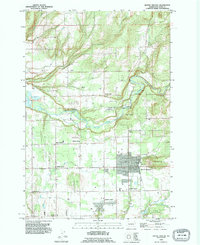
1990 Map of Battle Ground
USGS Topo · Published 1995About this map
Battle Ground serves as the central hub of this Clark County landscape, where the town's expanding footprint meets the agricultural and forested character of the Pacific Northwest. The East Fork Lewis River carves a winding path through the northern half of the sheet, bordered by Lewisville Park and the rural community of Lewisville. This 1990 revision illustrates the persistence of small family-named locales and historical crossroads such as King Corner, Dollar Corner, and Scotton Corner, which define the local geography alongside established settlements like Meadow Glade and Charter Oak.
Find a feature on this map
32 named features on this map. Tap any name to fly to it.
Don’t see what you’re looking for? This feature index may not catch every label — zoom into the map to look around manually.
Map Details
Editions of this 1990 Battle Ground Map
This is the sole edition of this map. No revisions or reprints were ever made.
Other maps of this area

1897 · Portland
USGS Topo · 1:62,500

1905 · Portland
USGS Topo · 1:62,500

1918 · Troutdale
USGS Topo · 1:62,500

1934 · Troutdale
USGS Topo · 1:48,000

1940 · Portland
USGS Topo · 1:62,500

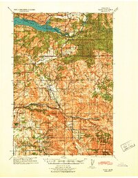
1940 · La Center
USGS Topo · 1:62,500
1941 · Yacolt
USGS Topo · 1:62,500

1941 · Camas
USGS Topo · 1:62,500

1942 · Camas
USGS Topo · 1:62,500

1948 · Vancouver
USGS Topo · 1:250,000