
1942 Map of Camas
USGS Topo · Published 1942About this map
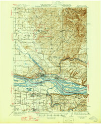
The Columbia River forms a wide, braided corridor through this early 1940s landscape, serving as the border between Washington and Oregon. On the northern bank, the industrial presence of Camas and Washougal sits below the rising slopes of Livingston Mountain and Mount Norway. The area is characterized by a mix of early 20th-century utility and defense, marked by the expansive Camp Bonneville Military Reservation and the remote Silver Star Mine in the northeastern highlands. South of the river, Oregon's transition from agricultural land to the growing communities of Gresham and Troutdale is visible, with the Union Pacific railroad and Columbia River Highway following the river's edge.
Find a feature on this map
78 named features on this map. Tap any name to fly to it.
Don’t see what you’re looking for? This feature index may not catch every label — zoom into the map to look around manually.
Map Details
Editions of this 1942 Camas Map
2 editions found
Other maps of this area

1897 · Portland
USGS Topo · 1:62,500

1905 · Portland
USGS Topo · 1:62,500

1911 · Boring
USGS Topo · 1:48,000

1914 · Boring
USGS Topo · 1:62,500

1914 · Oregon City
USGS Topo · 1:62,500

1916 · Estacada
USGS Topo · 1:125,000

1918 · Troutdale
USGS Topo · 1:62,500

1934 · Troutdale
USGS Topo · 1:48,000

1939 · Oregon City
USGS Topo · 1:62,500

1940 · Lookout Mtn
USGS Topo · 1:62,500