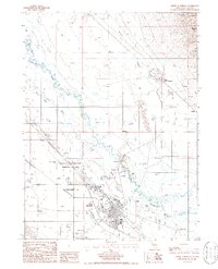
1985 Map of Battle Mountain
USGS Topo · Published 1986About this map
The Battle Mountain Indian Colony and the town of Battle Mountain serve as the focal points of this mid-1980s survey, situated where the Humboldt River meets the Reese River. The landscape is a complex network of waterways and historical transport routes, including the Old California Trail and the California Trail which trace the valley floor. The desert terrain is punctuated by several family-named agricultural operations, such as Licking Ranch, Broyles Ranch, and Welch Ranch, reflecting the enduring ranching economy of Lander County.
Find a feature on this map
27 named features on this map. Tap any name to fly to it.
Don’t see what you’re looking for? This feature index may not catch every label — zoom into the map to look around manually.
Map Details
Editions of this 1985 Battle Mountain Map
2 editions found
Other maps of this area

1932 · Sonoma Range
USGS Topo · 1:250,000

1939 · Sonoma Range
USGS Topo · 1:250,000

1940 · Antler Peak
USGS Topo · 1:62,500

1943 · Antler Peak
USGS Topo · 1:62,500

1955 · Winnemucca
USGS Topo · 1:250,000

1957 · Battle Mountain
USGS Topo · 1:62,500

1958 · Winnemucca
USGS Topo · 1:250,000

1962 · Winnemucca
USGS Topo · 1:250,000

1965 · Russells
USGS Topo · 1:24,000
1965 · Izzenhood Spring
USGS Topo · 1:24,000