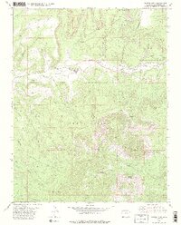
1979 Map of Battle Rock
USGS Topo · Published 1985About this map
The Ute Mountain Indian Reservation occupies a significant portion of this landscape, dominated by prominent elevations such as Ute Peak and Marble Mountain. The terrain is deeply incised by drainages like McElmo Creek and Cottonwood Wash, creating a complex network of canyons and mesas including Battle Rock Canyon and Hamilton Mesa. Human activity is concentrated along the creek bottoms, where industrial and agricultural signatures emerge.
Find a feature on this map
31 named features on this map. Tap any name to fly to it.
Don’t see what you’re looking for? This feature index may not catch every label — zoom into the map to look around manually.
Map Details
Editions of this 1979 Battle Rock Map
2 editions found
Other maps of this area

1956 · Cortez
USGS Topo · 1:250,000

1957 · Moqui NW
USGS Topo · 1:24,000

1957 · Moqui SW
USGS Topo · 1:24,000

1957 · Moqui SE
USGS Topo · 1:24,000

1958 · Sentinel Peak NW
USGS Topo · 1:24,000

1958 · Cortez SW
USGS Topo · 1:24,000

1958 · Sentinel Peak NE
USGS Topo · 1:24,000

1958 · Cortez
USGS Topo · 1:250,000

1959 · Cortez
USGS Topo · 1:250,000

1962 · Cortez
USGS Topo · 1:250,000