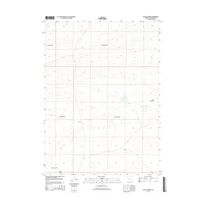
2015 Map of Battle Spring
USGS Topo · Published 2015About this map
Great Divide Basin terrain defines this high-desert portion of Sweetwater County, where the interior drainage creates a distinct landscape of flats and seasonal draws. Centrally located on the sheet, Battle Spring serves as a primary hydrological landmark, giving its name to both the Battle Spring Flat to the south and the winding Battle Spring Draw that cuts across the eastern sections. This 2015 survey reflects the contemporary infrastructure of the region, showing the network of Bureau of Land Management routes like Blm-3217 and Blm-3203 alongside county roads Cr-23 and Cr-63. These roads provide the primary access through the grid-like township and range divisions, connecting the remote basin floors with the surrounding high country. The map captures a high plateau environment shaped by traditional western water rights and grazing access within the Red Desert area.
Find a feature on this map
12 named features on this map. Tap any name to fly to it.
Don’t see what you’re looking for? This feature index may not catch every label — zoom into the map to look around manually.
Map Details
Editions of this 2015 Battle Spring Map
This is the sole edition of this map. No revisions or reprints were ever made.
Other maps of this area

1954 · Rawlins
USGS Topo · 1:250,000

1954 · Rock Springs
USGS Topo · 1:250,000

1955 · Lander
USGS Topo · 1:250,000

1955 · Casper
USGS Topo · 1:250,000

1958 · Rawlins
USGS Topo · 1:250,000

1958 · Casper
USGS Topo · 1:250,000

1958 · Lander
USGS Topo · 1:250,000

1958 · Rock Springs
USGS Topo · 1:250,000

1960 · Battle Spring
USGS Topo · 1:24,000

1960 · Hansen Lake NE
USGS Topo · 1:24,000