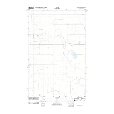
2011 Map of Battleview
USGS Topo · Published 2011About this map
Battleview serves as a central point in this northern prairie landscape, situated near the headwaters of the White Earth Creek. The map documents a territory defined by a dual economy of traditional agriculture and energy extraction, evidenced by the presence of the North Tioga Gas Plant and the East Tioga Oil and Gas Field in the southern section. For those researching local heritage, the landscape is punctuated by sites of historical and genealogical significance, including the Bethel Cemetery just east of town and the Beauty Valley Cemetery situated in the southwestern corner. Hydrological features like Sletten Lake and the winding course of the White Earth River define the natural drainage patterns of this Burke County quadrangle.
Find a feature on this map
20 named features on this map. Tap any name to fly to it.
Don’t see what you’re looking for? This feature index may not catch every label — zoom into the map to look around manually.
Map Details
Editions of this 2011 Battleview Map
This is the sole edition of this map. No revisions or reprints were ever made.
Other maps of this area

1953 · Williston
USGS Topo · 1:250,000

1957 · Williston
USGS Topo · 1:250,000

1969 · Ross NW
USGS Topo · 1:24,000

1969 · White Earth
USGS Topo · 1:24,000

1974 · Grubb Lake
USGS Topo · 1:24,000

1974 · McGregor
USGS Topo · 1:24,000

1974 · Grand View
USGS Topo · 1:24,000
1974 · Bush Lake
USGS Topo · 1:24,000

1977 · Powers Lake
USGS Topo · 1:24,000

1978 · Battleview
USGS Topo · 1:24,000