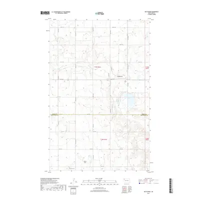
2017 Map of Battleview
USGS Topo · Published 2017About this map
Battleview is situated in the north-central plains of North Dakota, where the agricultural landscape meets the upper reaches of White Earth Cr. The area is characterized by a high-density grid of section-line roads, such as 80th St NW and 99th Ave NW, which partition the prairie into a network of farms and homesteads. The small settlement of Battleview sits along Railway St, reflecting the historical importance of rail access for grain transport in this region. Evidence of early rural community life is preserved through Bethel Cem and the Beauty Valley Cem, which serves the Beauty Valley area. Sletten Lake provides a natural landmark in an otherwise largely cultivated terrain, illustrating the glacial topography typical of the Burke and Mountrail county line.
Find a feature on this map
27 named features on this map. Tap any name to fly to it.
Don’t see what you’re looking for? This feature index may not catch every label — zoom into the map to look around manually.
Map Details
Editions of this 2017 Battleview Map
This is the sole edition of this map. No revisions or reprints were ever made.
Other maps of this area

1953 · Williston
USGS Topo · 1:250,000

1957 · Williston
USGS Topo · 1:250,000

1969 · Ross NW
USGS Topo · 1:24,000

1969 · White Earth
USGS Topo · 1:24,000

1974 · Grubb Lake
USGS Topo · 1:24,000

1974 · McGregor
USGS Topo · 1:24,000

1974 · Grand View
USGS Topo · 1:24,000
1974 · Bush Lake
USGS Topo · 1:24,000

1977 · Powers Lake
USGS Topo · 1:24,000

1978 · Battleview
USGS Topo · 1:24,000