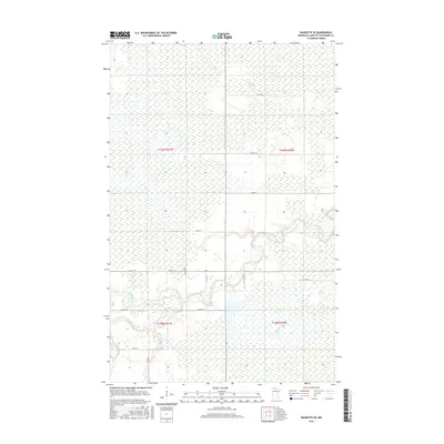
2016 Map of Baudette SE
USGS Topo · Published 2016About this map
The Rapid River and its various tributaries define this section of Lake of the Woods County, carving through a landscape characterized by extensive wetlands and low-lying drainages. The confluence of the N Br Rapid River and the main stem occurs in the southern half of the sheet, where the water is joined by Monroe Cr and Bartons Brook. This hydrological network has historically influenced the placement of rural infrastructure, visible in the winding routes of Co RD 83 and Co ST Aid HWY 16 as they parallel the riverbanks. The map documents the persistent township and range divisions, including t159n r31w and t158n r30w, illustrating the rectilinear grid of secondary roads like 39th ST Se and 11th Ave Se that negotiate the surrounding boggy terrain.
Find a feature on this map
20 named features on this map. Tap any name to fly to it.
Don’t see what you’re looking for? This feature index may not catch every label — zoom into the map to look around manually.
Map Details
Editions of this 2016 Baudette SE Map
This is the sole edition of this map. No revisions or reprints were ever made.
Other maps of this area

1919 · Knutson
USGS Topo · 1:62,500

1921 · Baudette
USGS Topo · 1:62,500

1954 · Roseau
USGS Topo · 1:250,000

1957 · Roseau
USGS Topo · 1:250,000

1958 · Roseau
USGS Topo · 1:250,000

1968 · Baudette SE
USGS Topo · 1:24,000

1968 · Clementson
USGS Topo · 1:24,000

1968 · Clementson SW
USGS Topo · 1:24,000
1968 · Baudette SW
USGS Topo · 1:24,000
1968 · Pitt
USGS Topo · 1:24,000