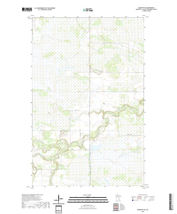
2022 Map of Baudette SE
USGS Topo · Published 2022About this map
The Rapid River winds through this expanse of northern Minnesota wetlands, where the hydrologic network defines the local geography. The river's path is joined by several tributaries, including the N Br Rapid River and the winding course of Monroe Cr. This landscape is characterized by a high water table and numerous seasonal drainages such as Bartons Brook and Mouse Cr, which flow through the marshy terrain of the Lake of the Woods region. A structured grid of secondary roads and county routes, such as Co Hwy 16 and Co Rd 147, provides the primary access points through the township sections. These routes generally follow the section lines of the Public Land Survey System, reflecting the late-era development of the region's transportation infrastructure across the boggy lowlands.
Find a feature on this map
22 named features on this map. Tap any name to fly to it.
Don’t see what you’re looking for? This feature index may not catch every label — zoom into the map to look around manually.
Map Details
Editions of this 2022 Baudette SE Map
This is the sole edition of this map. No revisions or reprints were ever made.
Other maps of this area

1919 · Knutson
USGS Topo · 1:62,500

1921 · Baudette
USGS Topo · 1:62,500

1954 · Roseau
USGS Topo · 1:250,000

1957 · Roseau
USGS Topo · 1:250,000

1958 · Roseau
USGS Topo · 1:250,000

1968 · Baudette SE
USGS Topo · 1:24,000

1968 · Clementson
USGS Topo · 1:24,000

1968 · Clementson SW
USGS Topo · 1:24,000
1968 · Baudette SW
USGS Topo · 1:24,000
1968 · Pitt
USGS Topo · 1:24,000