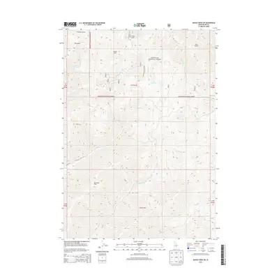
2013 Map of Baugh Creek SW
USGS Topo · Published 2013About this map
Sawtooth National Forest encompasses the majority of this high-elevation terrain in Blaine County, Idaho. The landscape is defined by a dense network of drainages and prominent peaks, with Patterson Peak standing as a significant landmark in the southwestern quadrant. This 2013 survey illustrates the complex topography of the Pioneer Mountains region, where steep ridges give way to geological features like The Narrows and Trail Canyon. Water sources are abundant and specifically named, including Baugh Cr, Ohio Gulch, and Slaughterhouse Cr. Human infrastructure is sparse, limited primarily to forest access routes such as Quigley Creek Rd and Nat For Dev Rd 124. The map provides a clear view of the drainage patterns that feed into the larger Wood River valley system, shown through features like Hailey Cr and Town Cr.
Find a feature on this map
29 named features on this map. Tap any name to fly to it.
Don’t see what you’re looking for? This feature index may not catch every label — zoom into the map to look around manually.
Map Details
Editions of this 2013 Baugh Creek SW Map
This is the sole edition of this map. No revisions or reprints were ever made.
Other maps of this area

1895 · Hailey
USGS Topo · 1:125,000

1897 · Hailey
USGS Topo · 1:125,000

1955 · Hailey
USGS Topo · 1:250,000

1957 · Bellevue
USGS Topo · 1:62,500

1957 · Bellevue
USGS Topo · 1:24,000

1959 · Hailey
USGS Topo · 1:250,000

1962 · Hailey
USGS Topo · 1:250,000

1967 · Baugh Creek SW
USGS Topo · 1:24,000

1967 · Baugh Creek
USGS Topo · 1:24,000

1967 · Sun Valley
USGS Topo · 1:24,000