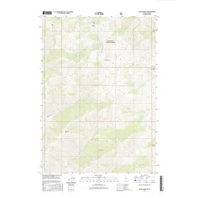
2017 Map of Baugh Creek SW
USGS Topo · Published 2017About this map
The Sawtooth National Forest dominates this high-elevation landscape, where deep drainages and steep ridges define the headwaters of numerous creeks. This 2017 survey details the complex network of gulches and canyons in Blaine County, including Driveway Gulch, Ohio Gulch, and Finley Gulch along the northern boundary. The terrain rises to notable high points such as Patterson Peak, while narrowing at a distinct geographic pinch point known as The Narrows. Drainage patterns are highly segmented, with Quigley Cr and Slaughterhouse Cr flowing through the central and southern sections. Infrastructure is sparse, primarily consisting of Forest Service access routes like Nat For Dev Rd 124 and Indian Creek Rd, which follow the natural contours of the valley floors to provide access to this protected wilderness area.
Find a feature on this map
26 named features on this map. Tap any name to fly to it.
Don’t see what you’re looking for? This feature index may not catch every label — zoom into the map to look around manually.
Map Details
Editions of this 2017 Baugh Creek SW Map
This is the sole edition of this map. No revisions or reprints were ever made.
Other maps of this area

1895 · Hailey
USGS Topo · 1:125,000

1897 · Hailey
USGS Topo · 1:125,000

1955 · Hailey
USGS Topo · 1:250,000

1957 · Bellevue
USGS Topo · 1:62,500

1957 · Bellevue
USGS Topo · 1:24,000

1959 · Hailey
USGS Topo · 1:250,000

1962 · Hailey
USGS Topo · 1:250,000

1967 · Baugh Creek SW
USGS Topo · 1:24,000

1967 · Baugh Creek
USGS Topo · 1:24,000

1967 · Sun Valley
USGS Topo · 1:24,000