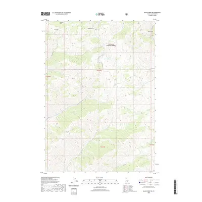
2020 Map of Baugh Creek SW
USGS Topo · Published 2020About this map
Sawtooth National Forest dominates the high-altitude landscape of Blaine County in this 2020 topographical study. The terrain is defined by a dense network of drainages and ridges, including the prominent Patterson Peak and the constricted geography of The Narrows. Numerous creeks, such as Baugh Creek and Quigley Creek, carve through the land, while named gulches like Ohio Gulch and Fowler Gulch mark the northern reaches.
Find a feature on this map
29 named features on this map. Tap any name to fly to it.
Don’t see what you’re looking for? This feature index may not catch every label — zoom into the map to look around manually.
Map Details
Editions of this 2020 Baugh Creek SW Map
This is the sole edition of this map. No revisions or reprints were ever made.
Other maps of this area

1895 · Hailey
USGS Topo · 1:125,000

1897 · Hailey
USGS Topo · 1:125,000

1955 · Hailey
USGS Topo · 1:250,000

1957 · Bellevue
USGS Topo · 1:62,500

1957 · Bellevue
USGS Topo · 1:24,000

1959 · Hailey
USGS Topo · 1:250,000

1962 · Hailey
USGS Topo · 1:250,000

1967 · Baugh Creek SW
USGS Topo · 1:24,000

1967 · Baugh Creek
USGS Topo · 1:24,000

1967 · Sun Valley
USGS Topo · 1:24,000