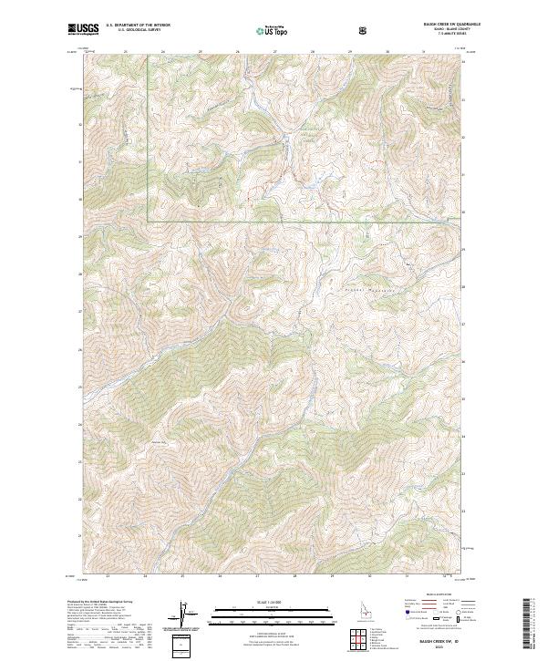
2023 Map of Baugh Creek SW
USGS Topo · Published 2023About this map
The Sawtooth National Forest dominates this section of the Pioneer Mountains in Blaine County, Idaho. High peaks and deep drainages define the landscape, notably Patterson Peak and the high-elevation passage known as The Narrows. A complex network of watercourses, including Baugh Creek, Quigley Creek, and Slaughterhouse Creek, dissects the terrain, illustrating the natural watershed patterns of the Idaho interior. Access into this high country is marked by forest service routes such as Nat For Dev RD 124 and the Cove Creek Connector Trl, which provide the primary means of navigating the canyons and gulches like Ohio Gulch and Trail Canyon. The map records a wilderness area defined by its hydrology and mountain topography rather than human settlement, serving as a primary reference for the geographic boundaries of the national forest and surrounding mountain ranges.
Find a feature on this map
25 named features on this map. Tap any name to fly to it.
Don’t see what you’re looking for? This feature index may not catch every label — zoom into the map to look around manually.
Map Details
Editions of this 2023 Baugh Creek SW Map
This is the sole edition of this map. No revisions or reprints were ever made.
Other maps of this area

1895 · Hailey
USGS Topo · 1:125,000

1897 · Hailey
USGS Topo · 1:125,000

1955 · Hailey
USGS Topo · 1:250,000

1957 · Bellevue
USGS Topo · 1:62,500

1957 · Bellevue
USGS Topo · 1:24,000

1959 · Hailey
USGS Topo · 1:250,000

1962 · Hailey
USGS Topo · 1:250,000

1967 · Baugh Creek SW
USGS Topo · 1:24,000

1967 · Baugh Creek
USGS Topo · 1:24,000

1967 · Sun Valley
USGS Topo · 1:24,000