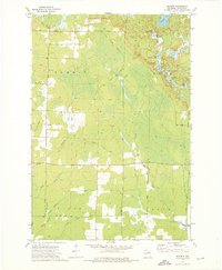
1973 Map of Bavaria
USGS Topo · Published 1976About this map
Bavaria and Ormsby anchor this early 1970s landscape in Langlade County, defined by a complex network of glacial lakes and creek drainages. The influence of the timber and transport era is visible through an extensive Old Railroad Grade that winds through the wetlands and forests, cutting through the townships of Summit and Upham. These rail corridors, often repurposed as local thoroughfares like Pratt Road or Sucker Rd, trace the historic path of industry through the Northwoods.
Find a feature on this map
32 named features on this map. Tap any name to fly to it.
Don’t see what you’re looking for? This feature index may not catch every label — zoom into the map to look around manually.
Map Details
Editions of this 1973 Bavaria Map
2 editions found
Other maps of this area

1899 · Wausau
USGS Topo · 1:125,000

1902 · Wausau
USGS Topo · 1:125,000

1940 · Parrish
USGS Topo · 1:48,000

1942 · Elcho
USGS Topo · 1:48,000

1950 · Elcho
USGS Topo · 1:48,000

1950 · Parrish
USGS Topo · 1:48,000

1951 · Doering
USGS Topo · 1:48,000

1952 · Parrish
USGS Topo · 1:48,000

1952 · Antigo
USGS Topo · 1:48,000

1954 · Iron Mountain
USGS Topo · 1:250,000