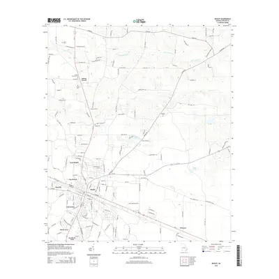
2014 Map of Baxley
USGS Topo · Published 2014About this map
Baxley serves as the primary hub of this landscape, situated at the crossroads of several major regional routes like Ga-15 and Ga-27. The surrounding residential development is characterized by distinct neighborhoods such as Cook Heights, Clay Homes, and Holt Homes, while the southern outskirts transition into areas like Shady Acres and Weatherly Park. These named communities illustrate the residential expansion of the county seat into its immediate rural surroundings.
Find a feature on this map
143 named features on this map. Tap any name to fly to it.
Don’t see what you’re looking for? This feature index may not catch every label — zoom into the map to look around manually.
Map Details
Editions of this 2014 Baxley Map
This is the sole edition of this map. No revisions or reprints were ever made.
Other maps of this area

1953 · Waycross
USGS Topo · 1:250,000

1958 · Waycross
USGS Topo · 1:250,000
1970 · Altamaha
USGS Topo · 1:24,000

1970 · Baxley NE
USGS Topo · 1:24,000
1970 · Altamaha SW
USGS Topo · 1:24,000

1970 · Pine Grove
USGS Topo · 1:24,000
1970 · Grays Landing
USGS Topo · 1:24,000

1970 · Baxley
USGS Topo · 1:24,000

1971 · Surrency
USGS Topo · 1:24,000

1971 · Alma NW
USGS Topo · 1:24,000