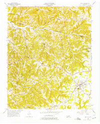
1955 Map of Baxter
USGS Topo · Published 1975About this map
The town of Baxter serves as a central hub on this mid-1950s survey of the Upper Cumberland, where the Tennessee railroad line cuts through a landscape defined by deep hollows and narrow ridges. Educational and religious institutions are prominent, from the Baxter Seminary in town to the Junior Military Academy at Bloomington Springs. The rural landscape is densely dotted with family-named burial grounds like Odd Fellows Cem, Bartlett Cem, and Rogers Cem, reflecting generations of settlement along the waterways of Indian Creek and Martin Creek.
Find a feature on this map
80 named features on this map. Tap any name to fly to it.
Don’t see what you’re looking for? This feature index may not catch every label — zoom into the map to look around manually.
Map Details
Editions of this 1955 Baxter Map
3 editions found
Other maps of this area

1925 · Gainesboro
USGS Topo · 1:62,500

1928 · Gordonsville
USGS Topo · 1:62,500

1929 · Gainesboro
USGS Topo · 1:62,500

1932 · Carthage
USGS Topo · 1:62,500

1942 · Statesville
USGS Topo · 1:100,000

1943 · Cookeville
USGS Topo · 1:100,000

1944 · Cookeville
USGS Topo · 1:100,000

1953 · Cookeville West
USGS Topo · 1:24,000

1955 · Baxter
USGS Topo · 1:24,000
1956 · Burgess Falls
USGS Topo · 1:24,000