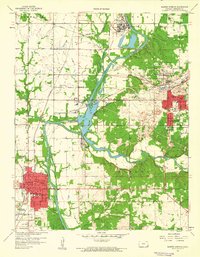
1959 Map of Baxter Springs
USGS Topo · Published 1960About this map
The Spring River and its confluence with Shoal Creek dominate the landscape of Cherokee County in the late 1950s. The region is defined by a dense intersection of industry and civic life, where the presence of a large Chemical Plant and various tailings piles indicate the area's mining and industrial heritage. The town of Baxter Springs serves as a primary hub, featuring neighborhoods served by Lincoln Sch, Washington Sch, and a local Hospital. To the northeast, the city of Galena shows a complex grid of streets and schools, including Liberty Sch and Spring Grove Sch. Rural genealogists will find numerous family landmarks, such as Quaker Valley Cem, Pence Cem, and the Friends Ch. Transportation is anchored by several rail lines, including the Kansas City Southern and St Louis San Francisco, which connect the border settlements of Riverton, Lowell, and Commonwealth near the Oklahoma state line.
Find a feature on this map
48 named features on this map. Tap any name to fly to it.
Don’t see what you’re looking for? This feature index may not catch every label — zoom into the map to look around manually.
Map Details
Editions of this 1959 Baxter Springs Map
2 editions found
Other maps of this area

1886 · Joplin
USGS Topo · 1:125,000

1894 · Joplin
USGS Topo · 1:125,000

1907 · Wyandotte
USGS Topo · 1:125,000

1909 · Wyandotte
USGS Topo · 1:125,000

1918 · Columbus
USGS Topo · 1:62,500

1947 · Joplin
USGS Topo · 1:250,000

1949 · Joplin
USGS Topo · 1:250,000

1949 · Racine
USGS Topo · 1:24,000

1950 · Racine
USGS Topo · 1:24,000

1954 · Tulsa
USGS Topo · 1:250,000