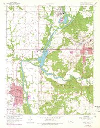
1959 Map of Baxter Springs
USGS Topo · Published 1979About this map
The Spring River Valley serves as the industrial and geographical spine of this Cherokee County survey, where the convergence of the Spring River and Shoal Creek defines the landscape. Heavy industry is prominent, marked by a large Chemical Plant to the north and numerous tailings piles concentrated around Galena, signaling the region's active mining operations. The urban footprint of Baxter Springs and Galena is clearly delineated, including residential expansion areas identified during the late 1970s revision process.
Find a feature on this map
47 named features on this map. Tap any name to fly to it.
Don’t see what you’re looking for? This feature index may not catch every label — zoom into the map to look around manually.
Map Details
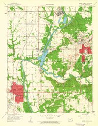
Editions of this 1959 Baxter Springs Map
2 editions found
Other maps of this area

1886 · Joplin
USGS Topo · 1:125,000

1894 · Joplin
USGS Topo · 1:125,000

1907 · Wyandotte
USGS Topo · 1:125,000

1909 · Wyandotte
USGS Topo · 1:125,000

1918 · Columbus
USGS Topo · 1:62,500

1947 · Joplin
USGS Topo · 1:250,000

1949 · Joplin
USGS Topo · 1:250,000

1949 · Racine
USGS Topo · 1:24,000

1950 · Racine
USGS Topo · 1:24,000

1954 · Tulsa
USGS Topo · 1:250,000