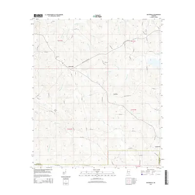
2015 Map of Baxterville
USGS Topo · Published 2015About this map
Baxterville sits at the center of this 2015 survey, serving as a primary settlement node within a landscape defined by an intricate network of creeks and wetlands in Lamar and Pearl River Counties. The geography is notable for its numerous brakes, including Burnt Reed Brake and Cooper Reed Brake, which suggest a low-lying, water-saturated environment characteristic of this part of southern Mississippi. Small settlements like Fanning and the edge of Lumberton anchor the eastern and southern margins, while several family-named landmarks such as Baxterville Cem and Myrtle Grove Cem provide valuable touchpoints for genealogical research.
Find a feature on this map
71 named features on this map. Tap any name to fly to it.
Don’t see what you’re looking for? This feature index may not catch every label — zoom into the map to look around manually.
Map Details
Editions of this 2015 Baxterville Map
This is the sole edition of this map. No revisions or reprints were ever made.
Other maps of this area

1953 · Hattiesburg
USGS Topo · 1:250,000

1953 · Mobile
USGS Topo · 1:250,000

1957 · Mobile
USGS Topo · 1:250,000

1958 · Hattiesburg
USGS Topo · 1:250,000

1958 · Carnes
USGS Topo · 1:62,500

1959 · Poplarville
USGS Topo · 1:62,500

1960 · Mobile
USGS Topo · 1:250,000

1963 · Mobile
USGS Topo · 1:250,000

1964 · Purvis
USGS Topo · 1:24,000

1964 · Lumberton
USGS Topo · 1:24,000