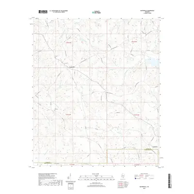
2018 Map of Baxterville
USGS Topo · Published 2018About this map
Baxterville sits at the heart of this landscape where the borders of Lamar and Pearl River counties meet. This region is defined by an intricate network of waterways, including the winding Little Black Cr and Wolf Cr, which drain into specialized wetland features like Cypress Reed Brake and Burnt Reed Brake. The settlement pattern follows older transit corridors like the Purvis to Baxterville Rd, while the presence of Tatum Salt Dome Rd hints at the area's subterranean geological significance. For genealogists, the map preserves the locations of the Baxterville Cem and Myrtle Grove Cem. Further south, the map captures the western outskirts of Lumberton, showing how the local economy and infrastructure were traditionally tied to the drainage basins of the W Hobolochitto Cr and the Middle Fork Cr.
Find a feature on this map
68 named features on this map. Tap any name to fly to it.
Don’t see what you’re looking for? This feature index may not catch every label — zoom into the map to look around manually.
Map Details
Editions of this 2018 Baxterville Map
This is the sole edition of this map. No revisions or reprints were ever made.
Other maps of this area

1953 · Hattiesburg
USGS Topo · 1:250,000

1953 · Mobile
USGS Topo · 1:250,000

1957 · Mobile
USGS Topo · 1:250,000

1958 · Hattiesburg
USGS Topo · 1:250,000

1958 · Carnes
USGS Topo · 1:62,500

1959 · Poplarville
USGS Topo · 1:62,500

1960 · Mobile
USGS Topo · 1:250,000

1963 · Mobile
USGS Topo · 1:250,000

1964 · Purvis
USGS Topo · 1:24,000

1964 · Lumberton
USGS Topo · 1:24,000