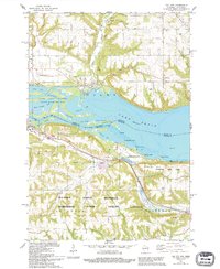
1974 Map of Bay City
USGS Topo · Published 1994About this map
Lake Pepin dominates this landscape where the Mississippi River widens along the border between Wisconsin and Minnesota. This 1974 survey shows the interplay of river commerce and recreation, featuring the Red Wing Airport and the Sawdust Bar near the Wisconsin Islands. On the Minnesota side, the village of Wacouta sits near the base of Rattlesnake Bluff, while the Wisconsin shore is home to Bay City and the inland settlement of Esdaile.
Find a feature on this map
54 named features on this map. Tap any name to fly to it.
Don’t see what you’re looking for? This feature index may not catch every label — zoom into the map to look around manually.
Map Details
Editions of this 1974 Bay City Map
2 editions found
Other maps of this area

1940 · Maiden Rock
USGS Topo · 1:62,500

1944 · Red Wing
USGS Topo · 1:62,500

1950 · Maiden Rock
USGS Topo · 1:62,500

1951 · Lake City
USGS Topo · 1:62,500

1952 · Red Wing
USGS Topo · 1:62,500

1953 · Saint Paul
USGS Topo · 1:250,000

1959 · Saint Paul
USGS Topo · 1:250,000

1968 · Goodhue East
USGS Topo · 1:24,000
1974 · Lake City NW
USGS Topo · 1:24,000
1974 · Lake City
USGS Topo · 1:24,000