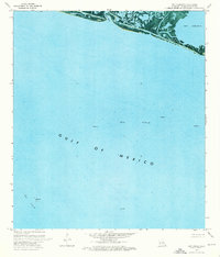
1973 Map of Bay Coquette
USGS Topo · Published 1976About this map
Pelican Island and the marshy fringes of the Louisiana coast define this orthophotomap, showing the delicate interface between the Mississippi Delta and the Gulf of Mexico. In the early 1970s, this landscape was a hub of energy production, dominated by the Oil Field and numerous offshore structures, including platforms and an Oil Well. The map captures the industrial footprint on the coastal environment, featuring man-made alterations such as dams, a jetty, and several drill holes scattered through the wetlands of Bayou Trouve. The transition from the inland waters of Bay Coquette and Scofield Bayou to the open sea provides a detailed perspective on the region's topography before significant modern coastal erosion altered these landforms.
Find a feature on this map
15 named features on this map. Tap any name to fly to it.
Don’t see what you’re looking for? This feature index may not catch every label — zoom into the map to look around manually.
Map Details
Editions of this 1973 Bay Coquette Map
This is the sole edition of this map. No revisions or reprints were ever made.
Other maps of this area

1892 · Quarantine
USGS Topo · 1:62,500

1893 · Forts
USGS Topo · 1:62,500

1893 · West Delta
USGS Topo · 1:62,500

1935 · Bastian Bay
USGS Topo · 1:31,680

1941 · Empire
USGS Topo · 1:62,500

1944 · Empire
USGS Topo · 1:62,500

1946 · Pass Du Bois
USGS Topo · 1:31,680

1946 · Pass Tante Phine
USGS Topo · 1:31,680

1947 · Buras
USGS Topo · 1:31,680

1947 · Fort St. Philip
USGS Topo · 1:31,680