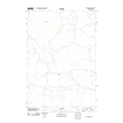
2011 Map of Bay Horse
USGS Topo · Published 2011About this map
Bay Horse serves as the focal point of this rural landscape along the Montana-Wyoming border. The terrain is defined by an intricate network of drainages, most notably Bay Horse Creek, which winds through the center of the sheet toward the northern boundary. Water management is evident at the Traubnumber 3 Dam in the northwest, a critical piece of infrastructure for this arid region. The map highlights the intersection of local transportation and natural features, where Recluse Rd and Bowers Creek Rd provide access through a series of creek valleys. These waterways, including Butte Creek and Bowers Creek, illustrate a complex watershed system where intermittent flows and named tributaries like the North Fork Bowers Creek and Deep Creek carve out the local topography.
Find a feature on this map
13 named features on this map. Tap any name to fly to it.
Don’t see what you’re looking for? This feature index may not catch every label — zoom into the map to look around manually.
Map Details
Editions of this 2011 Bay Horse Map
This is the sole edition of this map. No revisions or reprints were ever made.
Other maps of this area

1954 · Ekalaka
USGS Topo · 1:250,000

1954 · Gillette
USGS Topo · 1:250,000

1955 · Gillette
USGS Topo · 1:250,000

1956 · Ekalaka
USGS Topo · 1:250,000

1958 · Gillette
USGS Topo · 1:250,000

1958 · Ekalaka
USGS Topo · 1:250,000

1962 · Gillette
USGS Topo · 1:250,000

1965 · Ekalaka
USGS Topo · 1:250,000

1970 · Wild Bill Creek
USGS Topo · 1:24,000

1970 · Baldy Peak
USGS Topo · 1:24,000