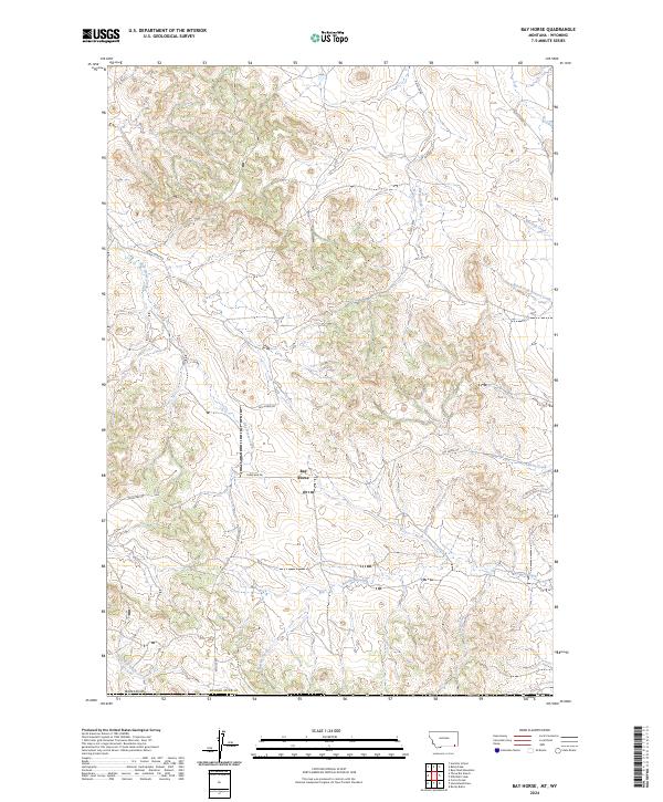
2024 Map of Bay Horse
USGS Topo · Published 2024About this map
Bay Horse and its surrounding creek-carved landscape define this portion of Powder River Co in eastern Montana. The map reveals a drainage system where Butte Creek and Mitchell Creek flow through the northern reaches, while Bay Horse Creek and Bowers Creek dominate the central and southern terrain. These watercourses are the primary geographical anchors for the ranching lands that occupy this territory.
Find a feature on this map
18 named features on this map. Tap any name to fly to it.
Don’t see what you’re looking for? This feature index may not catch every label — zoom into the map to look around manually.
Map Details
Editions of this 2024 Bay Horse Map
This is the sole edition of this map. No revisions or reprints were ever made.
Other maps of this area

1954 · Ekalaka
USGS Topo · 1:250,000

1954 · Gillette
USGS Topo · 1:250,000

1955 · Gillette
USGS Topo · 1:250,000

1956 · Ekalaka
USGS Topo · 1:250,000

1958 · Gillette
USGS Topo · 1:250,000

1958 · Ekalaka
USGS Topo · 1:250,000

1962 · Gillette
USGS Topo · 1:250,000

1965 · Ekalaka
USGS Topo · 1:250,000

1970 · Wild Bill Creek
USGS Topo · 1:24,000

1970 · Baldy Peak
USGS Topo · 1:24,000