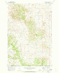
1970 Map of Bay Horse
USGS Topo · Published 1973About this map
Bay Horse lies along the transition between the rolling uplands of Powder River County, Montana, and Campbell County, Wyoming. Mapped just before its publication in 1973, this sheet captures a landscape defined by ranching and resource exploration. The drainage network is particularly dense, centered on Bay Horse Creek and Butte Creek, which carve through the terrain alongside numerous named tributaries like North Fork Bowers Creek and Three Bar Creek.
Find a feature on this map
17 named features on this map. Tap any name to fly to it.
Don’t see what you’re looking for? This feature index may not catch every label — zoom into the map to look around manually.
Map Details
Editions of this 1970 Bay Horse Map
This is the sole edition of this map. No revisions or reprints were ever made.
Other maps of this area

1954 · Ekalaka
USGS Topo · 1:250,000

1954 · Gillette
USGS Topo · 1:250,000

1955 · Gillette
USGS Topo · 1:250,000

1956 · Ekalaka
USGS Topo · 1:250,000

1958 · Gillette
USGS Topo · 1:250,000

1958 · Ekalaka
USGS Topo · 1:250,000

1962 · Gillette
USGS Topo · 1:250,000

1965 · Ekalaka
USGS Topo · 1:250,000

1970 · Wild Bill Creek
USGS Topo · 1:24,000

1970 · Baldy Peak
USGS Topo · 1:24,000